Historic Maps
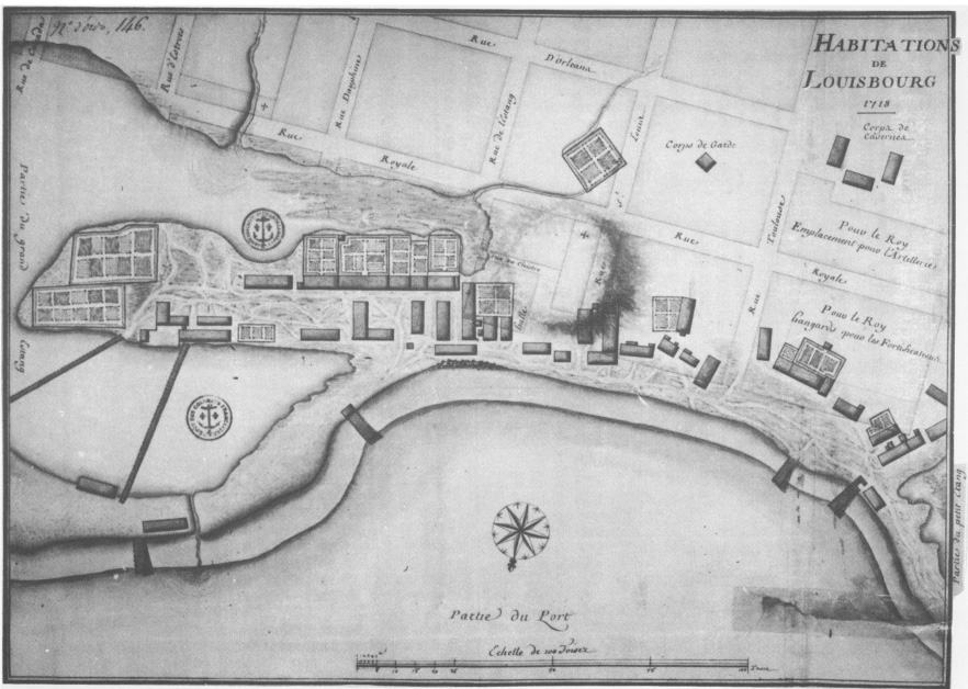
Plan of houses there before the Construction of the Fortress (1718)
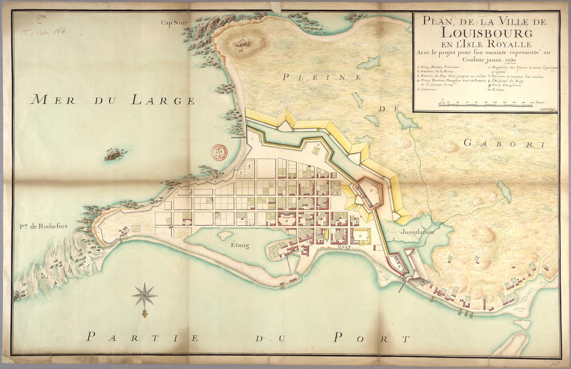
Plan de la Ville de Louisbourg en L'Isle Royale (1730)
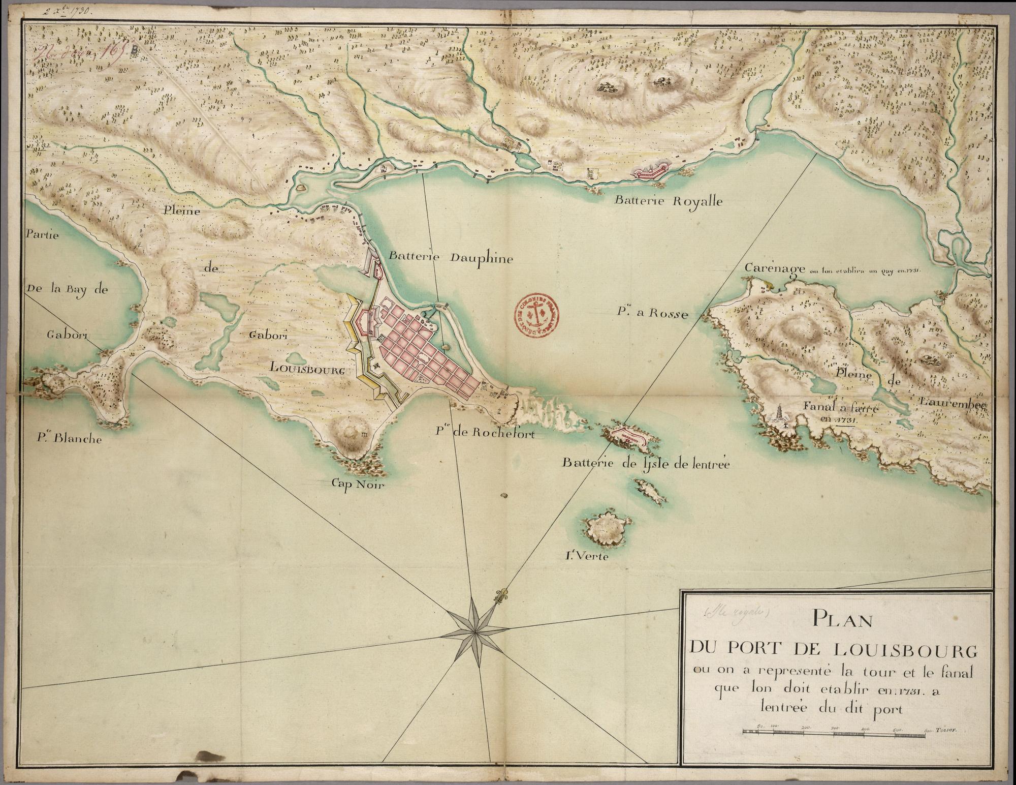
Plan du Port de Louisbourg (1730)
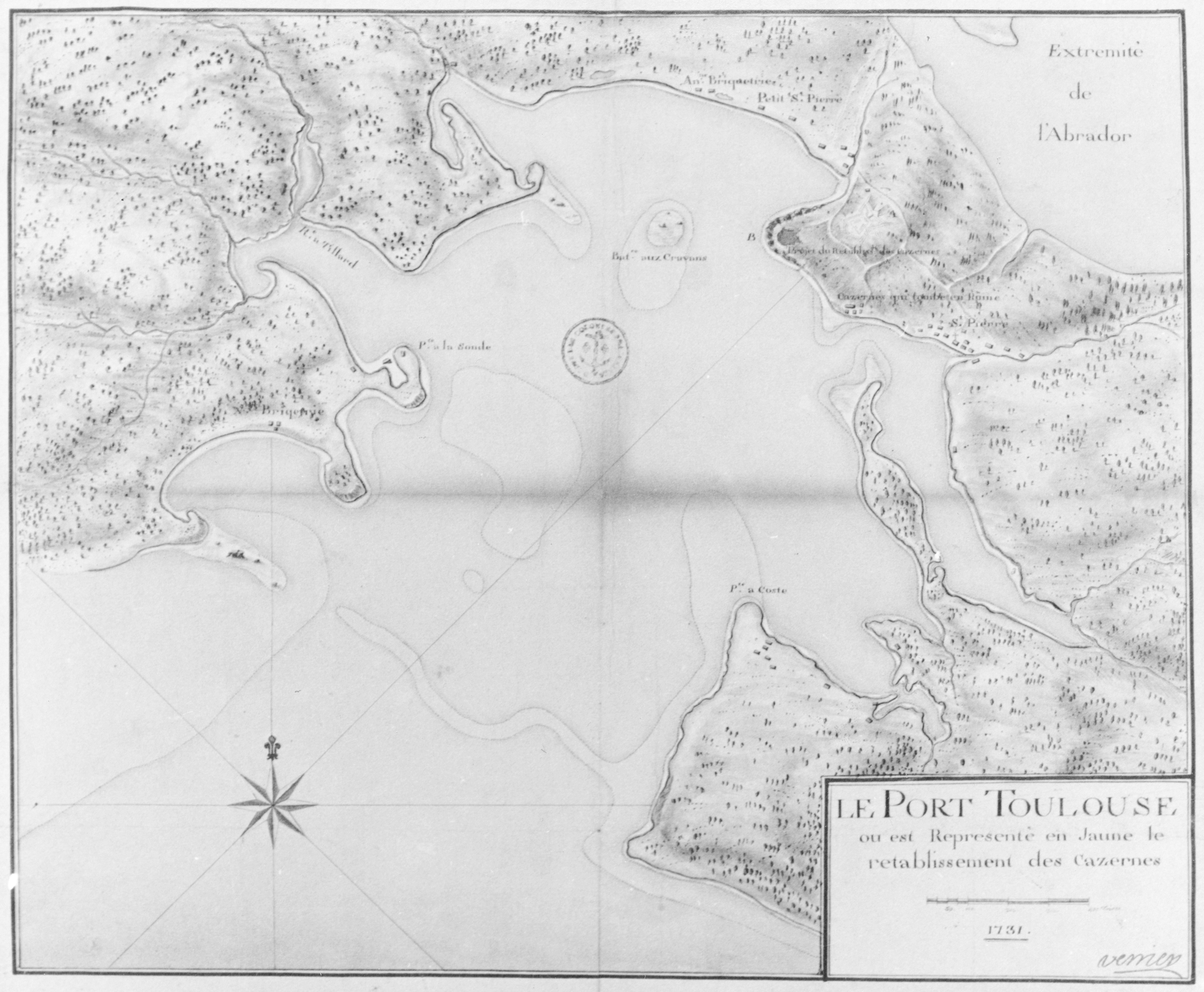
Plan of Port Toulouse, naval base’s supply port of Louisbourg located 120 kilometers to the northeast (1731)
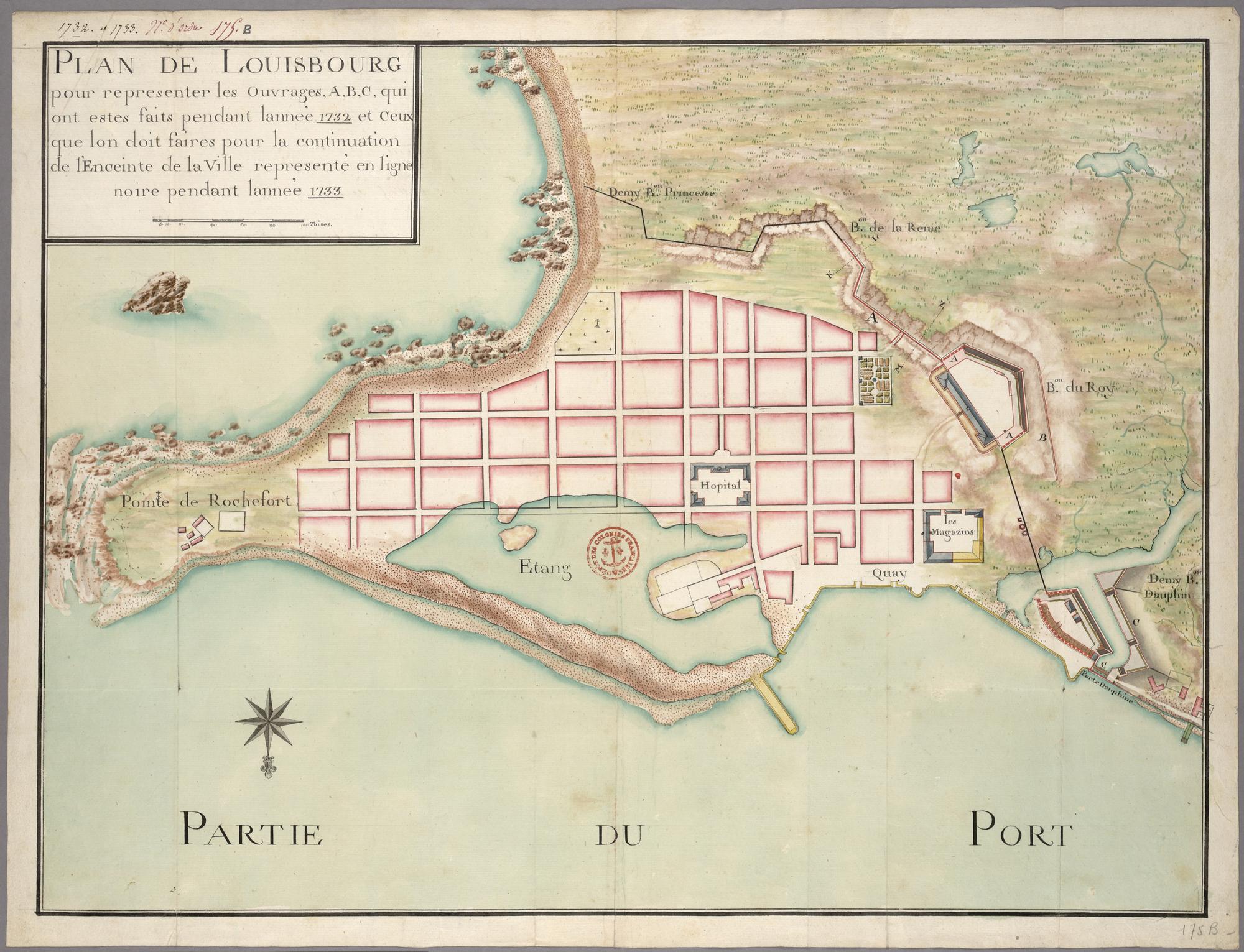
Plan of Louisbourg (1732)

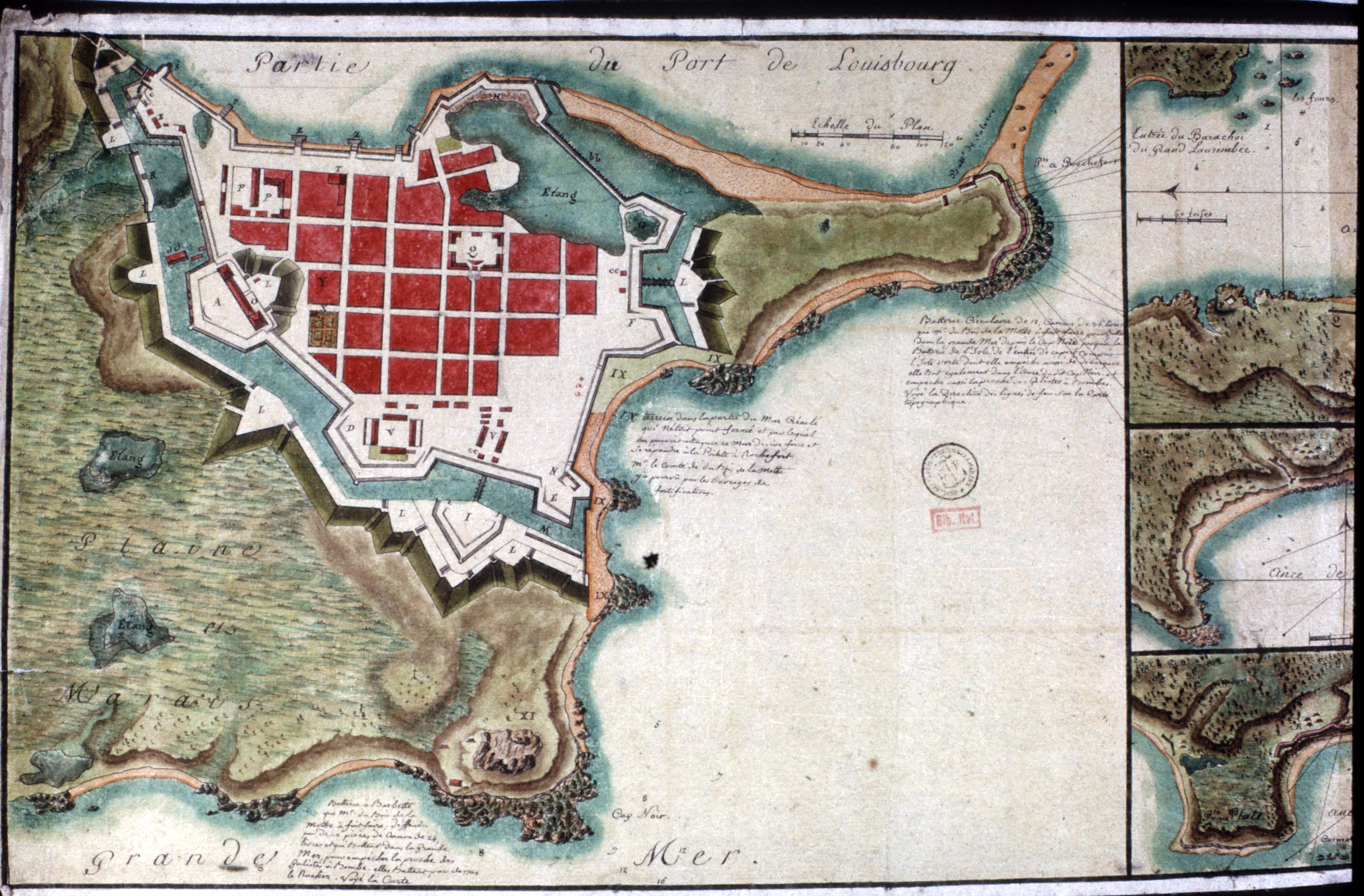
Plan of Rochefort Point (1752)
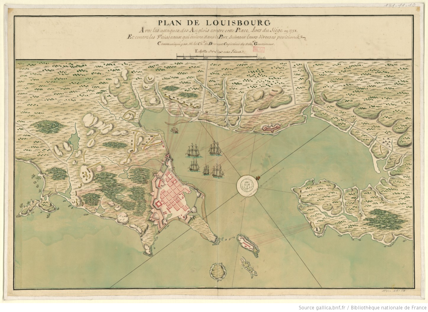
French Defenses map (1758)
Plan of Louisbourg, marked external cemetery (1758)
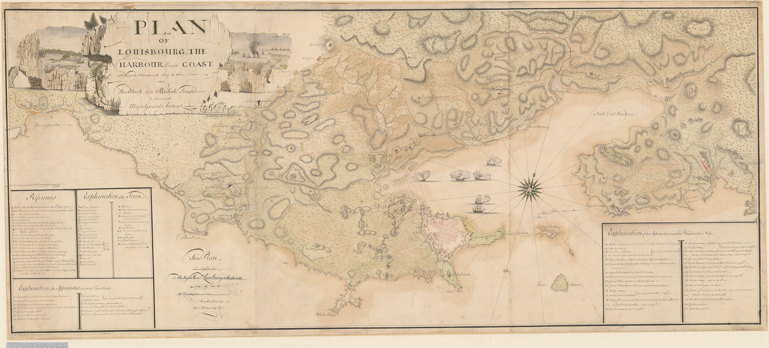
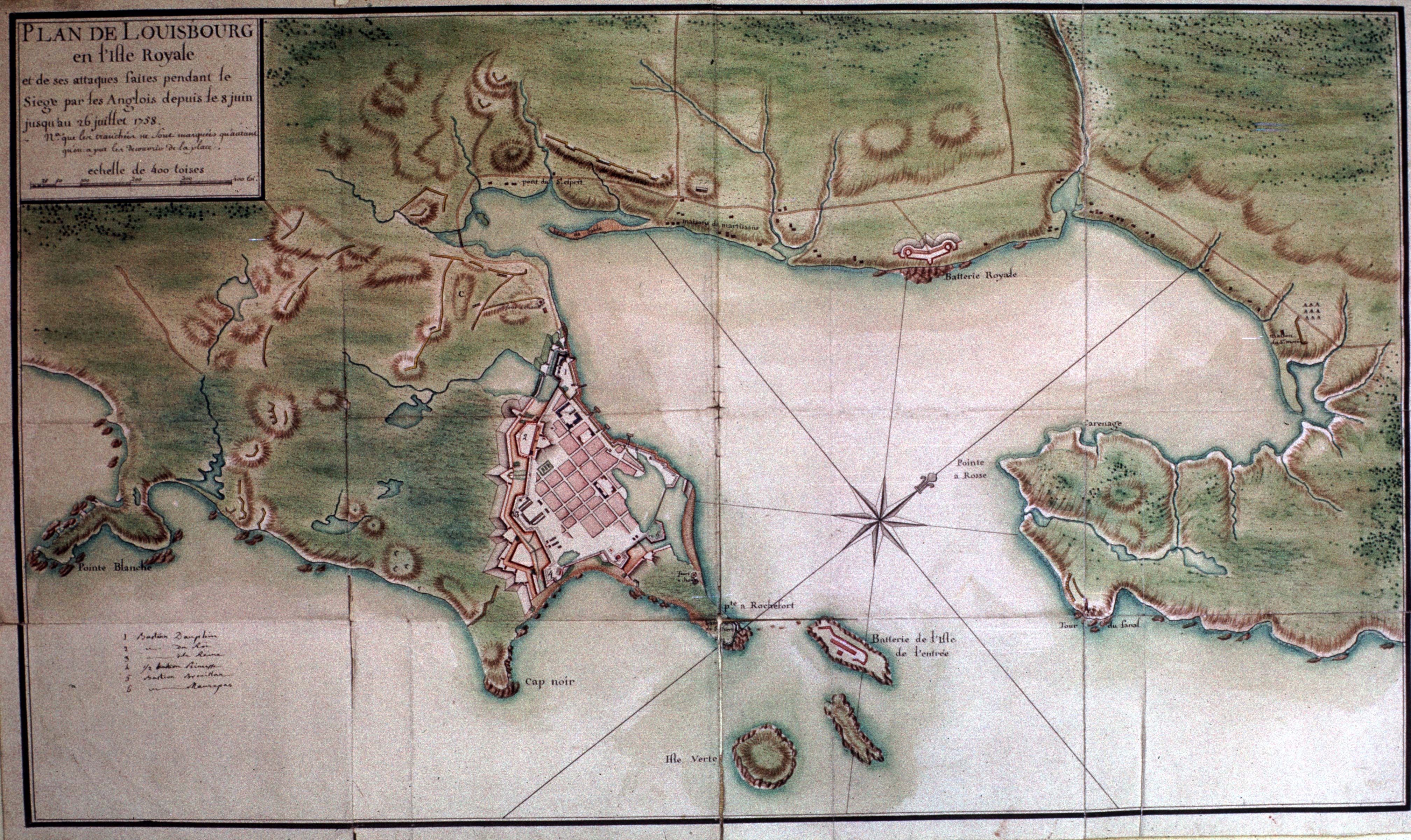
Plan of Louisbourg and surrounding areas after the British Attack (1758)
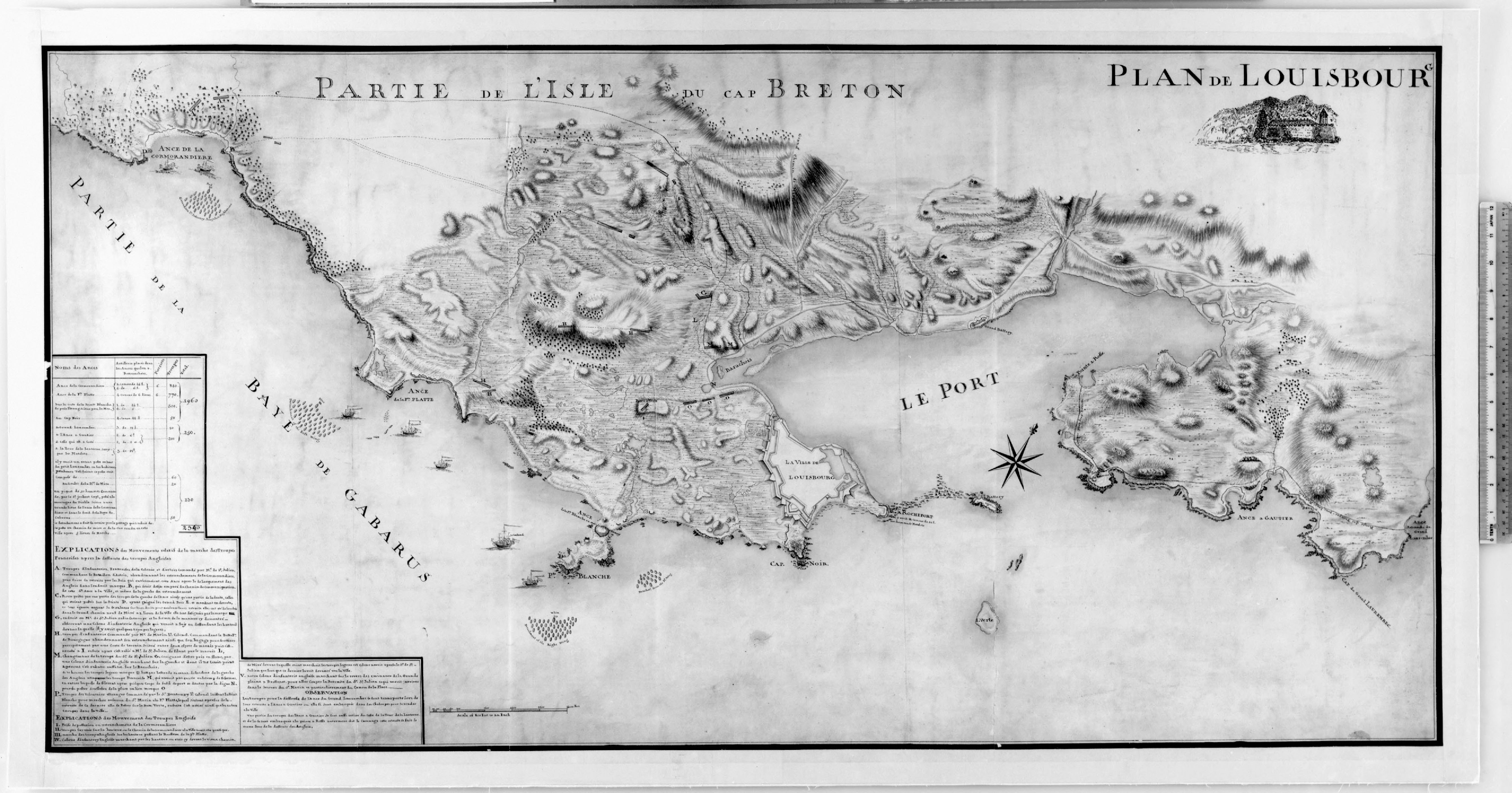
Plan of the British Attack routes to Louisbourg (1758)
Topographical Map of Louisbourg (1758)
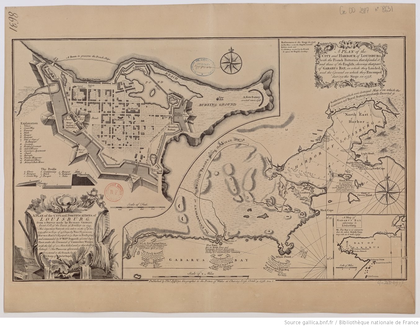
English map of the Plan of Louisbourg (1758)

Shoreline erosion between 1759 and 1998 with historic Louisbourg map overlay